ADMS Data Quality: How Good is Good Enough? (Part 2)
In a previous post we discussed the importance of GIS data quality when considering implementation of an Advanced Distribution Management System (ADMS). Even if you’ve been successfully supplying an outage system from your GIS that doesn’t mean you have sufficient completeness or quality to support an ADMS. The OMS requires complete and accurate connectivity, but it largely doesn’t care about things like the current carrying capabilities of individual primary spans. And it doesn’t really care customer usage patterns. But the ADMS does. And the ADMS wants that information correct and up to date every day.
But we also know that it’s not possible to be perfect. If perfect GIS data was an absolute requirement for an ADMS rollout, well then none would ever roll out. A corollary to this notion is that quality within any GIS database varies. It may vary my region, or by type of equipment or by voltage level (i.e., primary versus secondary). And it may vary in all three of these dimensions.
All of which brought us to our question of the day, “how good is good enough?”
It Depends
Like many things, the answer is not so simple. In part this is because “good enough” depends the goals for your ADMS implementation.  An ADMS includes many functions and the functions driven by your business case will in turn drive data accuracy requirements. In other words, some ADMS functions require more data and greater accuracy than others.
If, for example, your principle business driver is Volt/VAR Optimization (VVO) then incorporating accurate representations of proposed equipment might not be so important. Or if your driver is to support switching operations and VVO is not so important (possibly because you don’t have the equipment in the field to support it) then complete and accurate details about all capacitor controls might not be the highest on your priority list.
And as we know, establishing and maintaining high quality GIS data is not inexpensive. So, before jumping in to a wholesale program to improve GIS quality in order to support your future ADMS plans, make sure you have a good handle on your key target ADMS functions and organize your data quality efforts around those requirements.
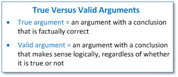
“Valid” is not the same as “Correct”
And before going further we have to reiterate this point that all too often gets overlooked. Just because a primary span’s wire size and material values are not Null and fall within their respective valid value domains does not mean the data in your GIS matches what’s in the field.
Maybe you’ve got a program where periodic field surveys are done to assess and improve GIS data correctness. Or maybe your field crews regularly note discrepancies between GIS features and equipment in the field using their mobile mapping units and sending this to your GIS team for update. Of maybe you’re taking some other steps to ensure data in the GIS matches what’s in the field. But if you don’t and you’re thinking about an ADMS down the road, then you might
Some Answers
We posed the question and got feedback in a variety of ways, mostly informal. But it seems an important enough question for us to summarize current findings – which may inspire more thought and more feedback.
Reponses fell into these three categories.
1. The Bar Is Set by ADMS Validation Itself
This set of responses made the point that getting the GIS (and other source) data to the point of meeting ADMS data validation requirements was the primary hurdle. The very high level of validation required to get the data in to the ADMS ensured that quality was high from the start.
Further, it won’t be the case that you load a set of data into your ADMS solution the first time and it will be good to go. You’ll perform a preliminary set of data loads, possibly by choosing a set of feeders that is representative of the variety present in your system, the best performing and the worst, the most heavily loaded and the lightest, the longest and the shortest. Then you’ll review the results these with your vendor. Evaluate, make corrections and repeat.
2. You Won’t Know Until You Try
The first point to be made here is that if you’re already feeding your GIS data to an engineering analysis product (like Cyme, SynerGEE, Milsoft, DEW, etc.) and, importantly, if your system engineers are making sure that updates they make are getting back into to GIS, then you’ll be ahead of the game. If your engineers get raw data from the GIS, massage it to make their model work correctly and don’t communicate the updates back, then you might consider changing that work flow.
The second is, and we’re paraphrasing here, “you’ve got to throw the pomegranate against the wall and see what sticks.” Quality issues will fall out as you iterate through the process.
3. Compare Actual and Estimated
Once you’ve got data loaded and your state estimation model working in some fashion then you can compare voltage, current and other calculated properties with corresponding values provided by sensors located on the network in the field.  It will be likely that the variance between estimated and actual will vary across your service territory. Areas that need improvement will stand out.
Your state estimation model will use telemetry to calibrate calculated values for non-telemetered points. Though there may be a “correction” applied to telemetered values by the ADMS to account for time variations in telemetered readings. You’ll likely work with your ADMS vendor to agree on the appropriate amount of correction to be applied.
Summary
Every company we have talked with that has implemented an ADMS has had to invest in improving the quality of their GIS data that’s feeding the ADMS. Some have invested quite a large amount. If you’re thinking of implementing your own ADMS then you know your GIS data will need to be good, but one of the key questions you’ll need to ask yourself is “how good is good enough?” In this post we tried to address how this question will vary based on the business drivers propelling your ADMS and provide some feedback we’ve received on the ways other companies have answered the question for themselves.


